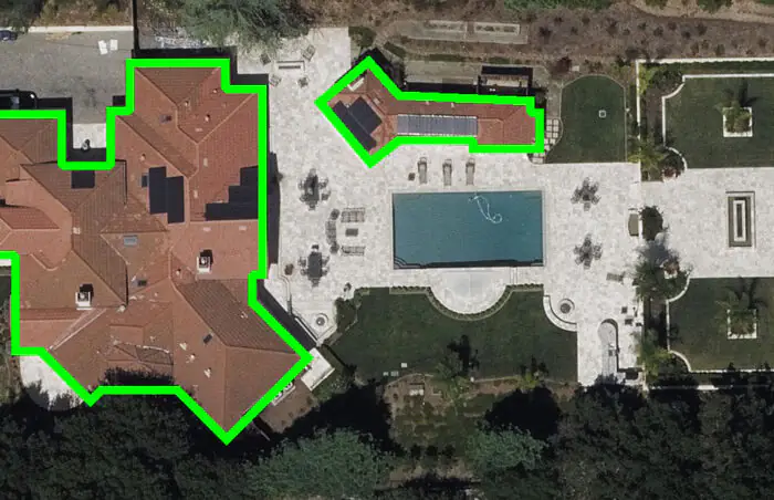
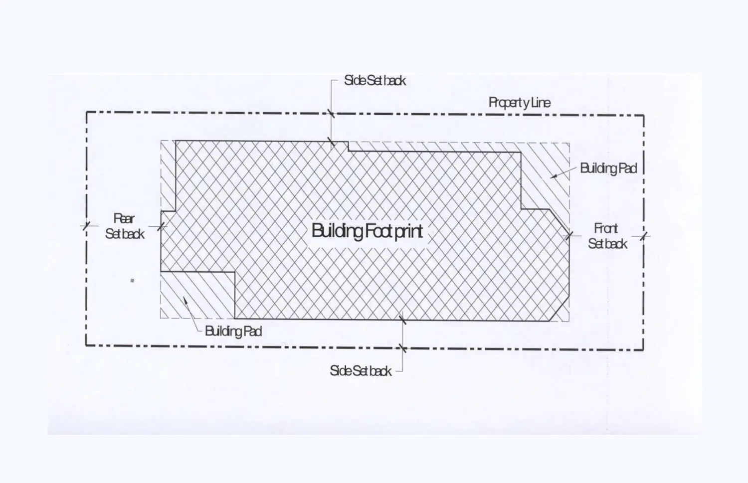
The Building Footprint generally excludes roof overhangs, eaves, open porches and terraces, balconies and exterior staircases, and open, enclosed courtyards. There is no single method for determining footprint. The concept of Footprint is used in architecture, urban studies, and urban geography and analytics.
In architecture, construction and urban planning regulation, the Building Footprint, or Footprint Area, is one of the parameters describing an object. But mostly Footprint Area is considered together with the area of the plot and its boundaries.
Building and urban planning regulations often set limits for the Footprint Area and the setback from the site boundaries. In this case, it is important to define the footprint accurately—the question of how the footprint is defined and which elements are included and which are not—and what to do with eaves, canopies and terraces becomes a fundamental issue. The answer to this question is to be found in the regulations that govern the footprint and its relation to the total plot area.
The concept of Footprint is also used in any field that uses geographic information systems, or GIS—systems designed to collect, store, analyse and visualise data about space and the objects in it.
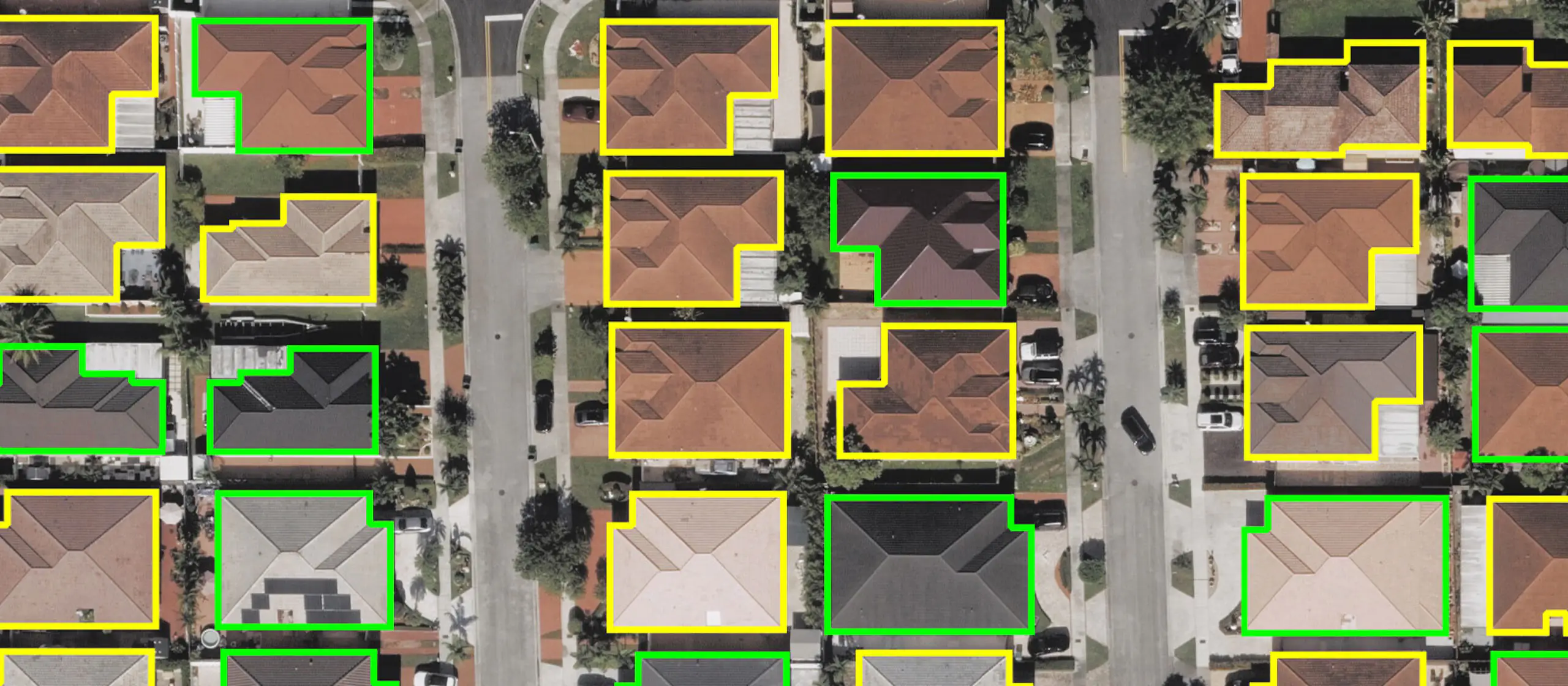
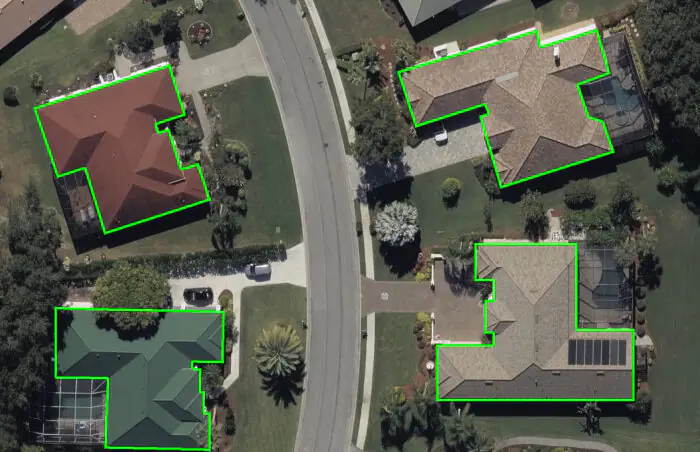
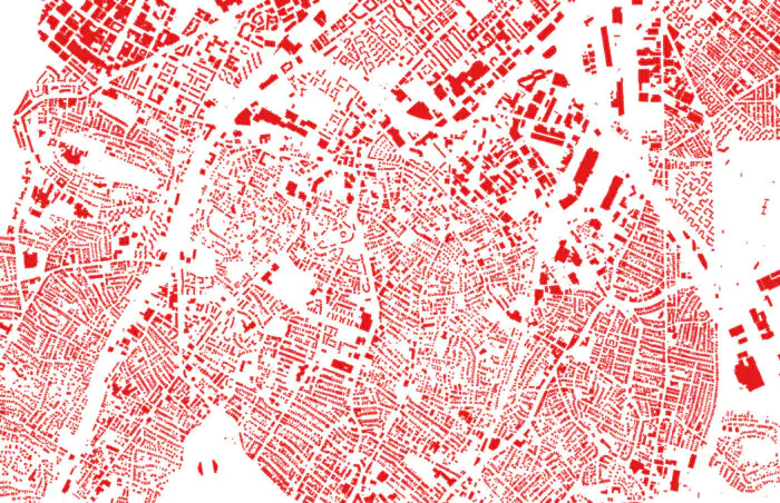
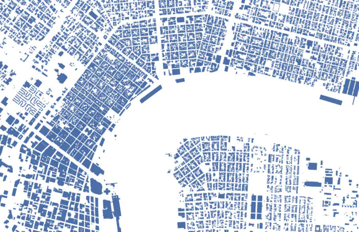
In digital cartography, a Building Footprint is simply a polygon on a map, the physical outline of an individual building. The polygon itself is useful in distinguishing a single building from its surroundings (trees, gardens, roads and other structures) but it becomes truly useful to cartographers and analysts with the data, which is the information that is embedded in it.
Footprints in GIS systems store building data, including open data, that are essential for working with the city: numerical data (e.g. number of floors or year of construction), qualitative data (purpose of the building or the material from which it is made), and 3D depictions of buildings derived from high-resolution satellite imagery.
The accuracy of footprints and their boundaries at this scale is not as important as when working with individual plots: this is not work with individual buildings, but with entire building arrays and the urban fabric as a whole, so the possibility of simultaneous use of data on different objects comes to the fore, and their contours are determined by roof contours. What is important here is the totality of data obtained through automatic analysis of each individual footprint: for example, GIS systems help analysts to understand exactly how many buildings are located on a particular street, whether land use regimes have changed, whether old buildings have been demolished and replaced by new ones, what natural or urban objects are located near the buildings (rivers, forests, major transport interchanges).
Based on such analytics, professionals from different fields—architecture, urban planning, development, insurance, health care—can evaluate different urban sites and make decisions about how to deal with them.